Storm brings rain, high wind, rip currents to Delmarva
In Ocean City, rain and wind pounded the inlet area as waves broke across the jetty.
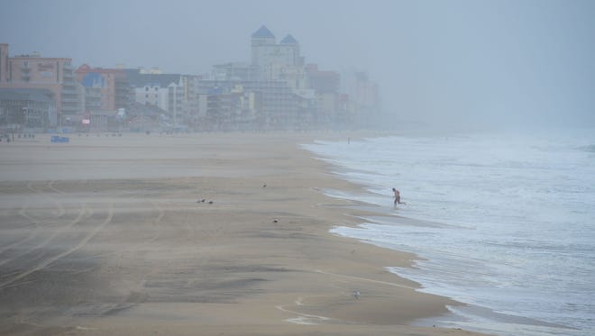
Rain came down in sheets, rendering the Boardwalk all but barren.
There were those, though, who did brave the storm to see how things were going.
Mitchell Banks of Walla Walla, Washington, was at the end of the Boardwalk taking photos of the rough conditions in the inlet.
Banks said he is in the midst of a cross-country road trip, and the weather Tuesday was among the most severe he has encountered.
"Definitely thankful I have my foul weather gear on," he said. "And the weather could be worse. At least we're safe here."
Delmarva could see flash flooding, dangerous swimming conditions and rough winds as a potential tropical cyclone continues its path up the Atlantic coast.
The National Weather Service has Accomack and Northampton counties under a coastal flood advisory until 8 p.m. and flash flood watch until 11 p.m. Tuesday. At about 10:20 a.m., Wicomico County, Somerset County, inland Worcester County and the Maryland beaches were also placed under flash flood watch until 11 p.m.
These areas will likely see at least 2 to 3 inches of rain, with the weather service reporting that there could be flooding in low areas along the shore, which could mean road closures.

BACKGROUND: Potential tropical system 'Irma' set to bring high winds, nor'easter conditions
Accomack and Northampton counties well as Maryland's Eastern Shore beaches will also be under high surf advisory until 4 a.m. Wednesday and the Delaware beaches until 6 a.m. Wednesday as the weather service is warning there is a high risk of rip currents, making it dangerous for people to venture into the water.
Because of dangerous surf and the risk of rip currents, Fenwick Island Beach Patrol tweeted Tuesday morning that the water will be closed all day.
In Ocean City, communications director Jessica Waters said they are monitoring the cyclone moving up the coast.
"We are expecting up to 3 inches of rain and sustained winds of 30 to 40 MPH with gusts up to 50 MPH," she said. "Our next high tide will occur at about 2:30 pm at which time we are expecting minor flooding in the downtown area."
The Ocean City Beach Patrol didn't restrict ocean access, but did issue a restriction requiring surfers to wear a leash.
In order to prevent sand erosion onto the Boardwalk, Waters said the sea wall gates have been closed because of the high winds.

"We are currently experiencing heavy surf with 8-12 foot waves and strong rip current conditions," she said. "Although we haven't seen many residents and visitors attempting to visit the beach today, we are asking that beachgoers only enter the water near a lifeguard."
Jessie Powell of Reisterstown, Maryland, said he was one of the beachgoers who considered going into the ocean today, but his wife stopped him.
He and his family are in Ocean City for one last vacation before school starts, and he said they decided to wait out the storm.
"If the whole week was going to be like this, then we would have gone home," he said. "But it's supposed to be nice after today."
The NWS has also issued wind advisories throughout Delmarva as winds are expected to be around 30 mph with gusts upwards of 40 mph in some areas. These advisories will last until 11 p.m. Tuesday for parts of Maryland and Virginia and midnight for parts of Delaware.
At Assateague State Park in Maryland, use of pop up campers and tents was suspended Tuesday.
Wind advisories for the Maryland beaches and Northampton and Accomack counties have been converted to high wind warnings, meaning these areas could see wind gusts as high as 55 mph, according to the weather service. These warnings will remain in effect until midnight.
Winds of this strength can down trees and power lines and cause minor roof or structural damage, according to a Tuesday morning Facebook update from the NWS Forecast Office in Wakefield.
The U.S. Coast Guard Captain of the Port of Hampton Roads set port conditions at "X-ray" as of 8:30 a.m. Tuesday, with gale force winds expected to reach the Virginia Capes within 24 hours, according to a news release.
The release states that commercial vessels will not be allowed to enter or depart the Chesapeake Bay after 10 a.m. Tuesday unless permission is granted by the COTP Hampton Roads. The closure is expected to last until at least Tuesday evening.
If vessel representatives believe there are circumstances that require an exception during the closure, they should contact the Sector Hampton Roads office at 757-638-6635 to request permission.
John McGee with the National Weather Service in Wakefield said the worst of the storm seemed to be passing through Delmarva Tuesday afternoon, with rain expected to taper off in the evening.
In a lot of places, he said about an inch of rain had fallen, with Virginia's Eastern Shore hit hardest. By Tuesday evening, he said he expected a total of 2 to 4 inches of rain to have fallen, with rain stopping before the sun comes up Wednesday
However, McGee said winds of 15 to 20 mph may continue through Wednesday morning, though overall it's expected to be a nice day.
Rain is forecasted to pick up again Friday, McGee said, as the remnants of Tropical Storm Harvey make their way through the area, with the weather taking a turn Friday night and continuing through early Sunday.
"During the day Saturday is probably going to be not that nice of a day," McGee said.
This will be updated.