Hermine gets Delaware's full attention
- Tropical storm watch issued for southern Delaware Bay
- Hermine's path sticking close to Carolina coasts
- Storm may strengthen after that as it moves over ocean
Hermine is going to make Labor Day weekend interesting. Soggy, but interesting.
The storm, which gathered moisture in the Gulf Coast and evolved from tropical storm to hurricane Thursday — before making land Friday and reverting to a tropical storm — will likely be yanked further west than forecasters first predicted early in the week when the storm was weaker.
The National Weather Service issued a tropical storm watch Thursday from Duck, North Carolina, to Sandy Hook, New Jersey, including the southern Delaware Bay and parts of the Chesapeake Bay.
At 5 a.m. Friday, the National Hurricane Center said what had been Hurricane Hermine had been downgraded to tropical storm status soon after it made landfall in Florida.
A new forecast for the storm shows it passing close to Delaware this weekend. And even areas not close to the center of the storm will likely see strong winds and heavy rain as it moves by.
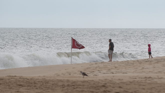
Sussex County's Emergency Operations Center said that between Saturday morning and Monday morning, "up to 4 inches of rain, 40 mph winds, rip currents, beach erosion and moderate flooding are possible."

Cookouts, beach visits, and charter fishing trips are becoming riskier propositions on what's normally the last big tourist weekend of the summer.
"It's not going to be fit for man or beast if it does what they say it's going to do," said Bert Adams, captain of the Judy V head boat docked at the Indian River Inlet. "It's going to be too nasty to go fishing Sunday. One of the three big weekends: boom, gone. Kiss it goodbye. If you didn't do well on the first two weekends, you're in trouble."
STORY: 7 Labor Day weekend events, from fireworks to festivals
STORY: Ed's Chicken DUI suspect's trial going to higher court
The latest forecasts by the National Hurricane Center show the storm coming closest to Delaware by Sunday morning. But its rain and wind may show up earlier, on Saturday, and the strong rip tides it could generate are a real concern.
"The worst time for you guys is going to be Saturday night into Sunday," said Steve Travis, an Accuweather.com meteorologist who studied the storm's likely impact on Delaware. "The earliest we would see this would be Saturday morning. There's the potential then that it could start to impact southern Delaware." Sustained winds could reach 30 to 40 mph, Travis said, with gusts higher than that.
It's been a summer largely free of major storms near the mid-Atlantic states, so Hermine — pronounced her-MEEN — is prompting the season's first concerns about a strong coastal storm.
STORY: To survive a rip current, stay calm
Todd Frichtman, captain of the Dewey Beach Patrol, said his lifeguards had been seeing stronger-than-normal waves all week, partly the effect of Hurricane Gaston far out to sea.
"Right now, the ocean's laid down flat. We had three- to four-foot surf all week, but now it's flat," Frichtman said.
No forecast he's seen has indicated any truly hairy conditions are likely to develop in Delaware, he said.
"We've seen all kinds of different predictions, up to six to seven feet of surf [on Sunday.] But it keeps changing," Frichtman said. "The public is welcome here; we'll be staffed and open. When you do come to the beach, only come to a beach with a lifeguard, and check in with them."
Delmarva Power, in a statement, said it had 300 linemen and tree crew workers prepared to fan out to reverse any power outages the storm may cause.

Travis said the storm will likely weaken on its way toward Delaware if, as expected, its center stays over Georgia and the Carolinas. But if it veers east once it's level with Virginia, the storm could re-strengthen a bit once it's over the open ocean again.
"For us, it's going to bring the threats of heavy rain, gusty winds. Beach erosion is certainly going to be a part of this storm," Travis said. "It’s just close enough, sitting offshore there, that it’ll bring rain and wind to coastal areas. It’s not like a [Tropical Storm] Sandy where it curves right back into the coast and made landfall.
"But if there's a small shift to the west, it's going to make a big difference."
Contact James Fisher at (302) 983-6772, on Twitter@JamesFisherTNJorjfisher@delawareonline.com.