Hurricane Willa remnants could affect Delaware's first nor'easter of the season
 Maddy Lauria
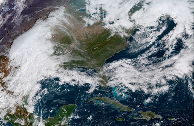
Delaware is in for a wet and windy end to the week as the first nor'easter of the season makes its way up the East Coast.
A strong mid-latitude cyclone — the meteorological term for what most people call a nor'easter — is expected to bring 1 to 2 inches of rain to Delaware Friday night into Saturday.
Rough coastal winds coming from the east, with gusts reaching more than 40 mph, could mean some coastal flooding for the area this weekend as well, said Delaware State Climatologist Daniel Leathers.
Coast wind could be biggest issue
"The big problem for us is going to be wind along the coast and probably some coastal flooding issues," he said. "There also could be some significant rains, but nothing right now looks like it is going to cause any huge problems."
Wind strength is expected to diminish further inland.
Impacts will first be felt sometime Friday night and continue into Saturday morning, with the worst to be seen in the southern coastal areas of the state. Coastal flooding is possible with the high tides on Saturday, Leathers said.
Not Willa, but Willa-related
"The other thing that is interesting is, even though it's not directly associated with Hurricane Willa that came onshore yesterday in Mexico, as this system moves up toward us, what's left of Willa kind of gets involved with a front across the Gulf and helps this thing take off a little bit," Leathers said. "Willa helps indirectly fuel this system to become fairly strong as it moves toward us."
Tide cycles between Friday and Saturday also could build up water along the coast, increasing the risk of coastal flooding. People should keep an eye on places along the bays that usually flood, such as Oak Orchard.
GOES-East CONUS View - GeoColor - NOAA / NESDIS / STAR
Watch the forecast
Because it is so early in the forecast, Leathers encouraged people to keep an eye on the forecast. Not much is expected to change, but the arrival of the strong winds and rain could fluctuate a few hours between now and this weekend.
"Midday Saturday is when things will kind of peak as far as any coastal flooding will go," he said. "Saturday morning is the worst of it."
One of southern Delaware's biggest fall events, the 29th annual Sea Witch Festival, could be in jeopardy if this storm hits Delaware's beaches as hard as expected on Saturday. Festival organizers posted on Facebook that the call to cancel Saturday's costume parade will not be made until Friday night or early Saturday morning. There is no scheduled rain date for the parade.
It's a normal weather pattern
Mid-latitude cyclones are normal storms for this time of year, and can be credited with delivering Delaware its weather patterns. Every year Delaware sees at least 30 coastal storms, including mid-latitude cyclones.

In October, those storms are normally the strongest. Nor'easters and mid-latitude cyclones will continue through late spring.
Hurricane season also lasts until the end of November. At this time, there are no threats from tropical storm systems for Delmarva. As of Wednesday, there was one relatively unorganized system in the middle of the Atlantic Ocean posing a 30 percent chance of developing into a tropical system.
Some areas already ahead on rainfall
While Delaware has seen a reprieve from rain compared to an unusually wet spring and summer, parts of the state have already seen precipitation far above normal. Leathers said northern parts of the state are running 7-9 inches above normal for rainfall this year.
More of the same:Wacky weather patterns present serious challenges for Delaware’s farmers
The National Weather Service forecast for Dover shows an 80 percent chance of heavy rain Friday night and Saturday with temperatures reaching a high of 56 degrees on Friday, and 58 degrees on Saturday with overnight lows in the mid- to upper-40s. Forecasts for the Wilmington area are similar, with temperatures just a few degrees lower.
There is an 80 percent chance of heavy rain Friday night and Saturday at the beaches, with temperatures expected to reach a high of 61 degrees on Saturday. High tide at the Indian River Inlet is set for 10:29 p.m. on Friday, 10:57 a.m. on Saturday and 11:15 p.m. on Saturday. Leathers said the early high tide on Saturday could result in the most coastal flooding risk.
What does this mean for Sea Witch?
Organizers of the Sea Witch Festival in Rehoboth Beach are getting ready for the bad weather and may adjust some of their plans.
But they won't make any final decisions about the costume parade until late Friday night or early Saturday morning, according to a Facebook post from the Rehoboth Beach and Dewey Beach Chamber of Commerce and Visitors Center.
In the event Saturday's parade is canceled due to weather, it will not be rescheduled, according to the Facebook post. Costume photos will be submitted via email for judging and awards.
Other Sea Witch activities will continue as planned, rain or shine, per the Facebook post. Updates regarding the festival will be communicated on social media.
The Ocean Pines Association in Ocean City, which is hosting a Halloween Fall Festival this weekend, is watching the weather forecast, as well.
Since the Fall Festival is a big event, not all of the carnival games can be moved inside. So if the weather is bad, the whole celebration will be canceled, said marketing and public relations director Denise Sawyer.
Contact reporter Maddy Lauria at (302) 345-0608, mlauria@delawareonline.com or on Twitter @MaddyinMilford.
DELAWARE'S TOP NEWS
Mega Millions jackpot results: Winning ticket worth $1.537 billion
8 years after winning $10.8 million, Delaware Lottery winner says life is 'marvelous'
Powerball jackpot: Drawing is Wednesday night for $620 million