Potential tropical storm 'Irma' set to bring high winds, nor'easter conditions
 Gray Hughes
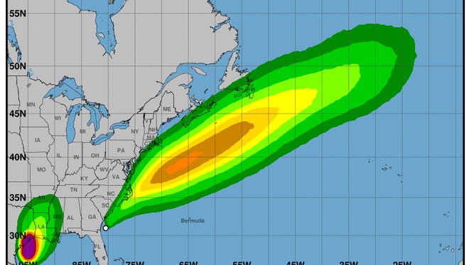
A tropical system, known now as Potential Tropical Cyclone X, is moving northward along the Atlantic coast and looks like it will impact Delmarva, the National Weather Service is reporting.
Although it is not yet a named storm, according to the weather service, it has an 80 percent chance of developing into one as of 2 p.m. on Monday.
TUESDAY UPDATE: Strong winds, dangerous rip currents expected
READ MORE: Tropical weather inching up east coast gathering strength
READ MORE: After Salisbury tornado, recovering and feeling 'lucky'
If it does, it will be named "Irma" and will become the 10th named storm this season.
According to NWS, weather associated with the storm will start to reach the region overnight, with the worst of the weather coming Tuesday during the day.
Worcester, Accomack and Northampton counties will all be under a high wind watch Tuesday afternoon into Tuesday night.
Northampton County is also under a high surf advisory until 4 a.m. on Tuesday.
The National Weather Service is calling for up to an inch of rain in Northampton County, three quarters of an inch in Accomack County and a half inch in Sussex, Somerset, Wicomico and Worcester counties.
However, Wayne Albright, a forecaster with the National Weather Service in Wakefield, Virginia, said it's up in the air whether it will become a named storm.
"It may or may not," he said. "There's no certainty. We just got off a conference call and they are keeping it the way it is right now."
In whatever form it takes on Delmarva, the storm will create nor'easter conditions along Delmarva, but especially in Ocean City, he said.
The resort can expect to see winds between 30 and 40 miles per hour, he said, with gusts as high as 50 miles per hour.
Minor to moderate tidal flooding is also possible along the Chesapeake Bay on Tuesday.
The U.S. Coast Guard captain at the Port of Hampton Roads has set Port Condition Whiskey due to the impending storm. Gale force winds are expected, and while the Port of Virginia remain open, all mariner are encouraged to take prudent actions to prepare for the impending weather.
From the Eastern Shore of Virginia 911 center: Heavy rain associated with a strong coastal low will begin to overspread the area late tonight through Thursday. 2 to 4 inches of rain will be possible near the coast with lesser amounts further inland. In addition to a Flash Flood Watch, a High Wind Watch is also in effect for coastal areas Tuesday morning through Tuesday evening for wind gusts to 50 mph.
The system was mostly stationary overnight, according to the National Hurricane Center. Slow and erratic motion is expected through the afternoon, followed by a faster northeastward track through the night and into Tuesday, when its expected to move along the North Carolina coast.
Rain is possible, with elevated tides in the ocean in the afternoon, Albright added.
Most local impacts will be coastal, including gale force winds, heavy surf and some beach erosion, according to Ray Kruzdlo with the National Weather Service.
"We don't consider it a big deal or something abnormal," Kruzdlo said. "Bigger storms or their remnants often come this way this time of the year."
Total rain accumulation along the upper South Carolina, North Carolina and southeast Virginia coasts is expected to be 3-6 inches, with isolated areas recieving as much as 9 inches, according to the Hurricane Center.
Information from The News Journal was used in this report.
On Twitter @hughesg19